This graduate seminar is taught in a lecture and lab exercise format. …
This graduate seminar is taught in a lecture and lab exercise format. The subject matter is tailored to introduce Environmental Engineering students to the use and potential of Geographic Information Systems in their discipline. Lectures will cover the general concepts of GIS use and introduce the material in the exercises, and exercises will introduce students to the practical application of GIS.
Essentials of Geographic Information Systems integrates key concepts behind the technology with …
Essentials of Geographic Information Systems integrates key concepts behind the technology with practical concerns and real-world applications. Recognizing that many potential GIS users are nonspecialists or may only need a few maps, this book is designed to be accessible, pragmatic, and concise. Essentials of Geographic Information Systems also illustrates how GIS is used to ask questions, inform choices, and guide policy. From the melting of the polar ice caps to privacy issues associated with mapping, this book provides a gentle, yet substantive, introduction to the use and application of digital maps, mapping, and GIS.
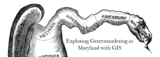
This activity will take students through the steps of visualizing Maryland's Congressional districts …
This activity will take students through the steps of visualizing Maryland's Congressional districts and calucalting the Polsby-Popper Test and interpreting the results using GIS with the ArcMap software application. This documents contains the instructors guide to the "Exploring Gerrymandering in Maryland with GIS" activity. Contents:Information about the scope and content of the activityRecommended readingsActivity Questions
This activity will take students through the steps of visualizing population and …
This activity will take students through the steps of visualizing population and cacluating population density using GIS with the ArcMap software application.
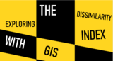
This activity will take students through the steps of calculating and intepreting …
This activity will take students through the steps of calculating and intepreting the Dissimilarity Index using GIS with the ArcMap software application.
This is not a typical e-book; it is a free, web-based, open-source …
This is not a typical e-book; it is a free, web-based, open-source “textbook” available to anyone interested in using mapping tools to create maps. This e-text focuses primarily on Geographic Information Systems (GIS)—a geospatial technology that enables you to create spatial databases, analyze spatial patterns, and produce maps that communicate more effectively. While this GIS textbook is principally an introduction to GIS, most of the chapter’s concepts are applicable to other geotechnologies including remote sensing, global positioning systems (GPS), Internet mapping, and virtual globes.
Creating good maps and analyzing spatial data is a time consuming and challenging practice, but recently, a new set of powerful mapping tools has enabled almost anyone with a computer to make maps easily and to perform at least some low-level analyses. The results, however, are not encouraging. Most of the new mapmakers do not have adequate training in mapping concepts and spatial analysis principles, and their maps are often improperly designed and do not communicate easily nor effectively. This e-text—GIS Commons—seeks to help you analyze spatial data and communicate more effectively. In short, GIS education is our goal.
Essentials of Geographic Information Systems integrates key concepts behind the technology with …
Essentials of Geographic Information Systems integrates key concepts behind the technology with practical concerns and real-world applications. Recognizing that many potential GIS users are nonspecialists or may only need a few maps, this book is designed to be accessible, pragmatic, and concise. Essentials of Geographic Information Systems also illustrates how GIS is used to ask questions, inform choices, and guide policy. From the melting of the polar ice caps to privacy issues associated with mapping, this book provides a gentle, yet substantive, introduction to the use and application of digital maps, mapping, and GIS.
Advanced seminar extends computer and analytic skills developed in the other subjects …
Advanced seminar extends computer and analytic skills developed in the other subjects in this sequence into a research environment. Students present a structured discussion of a journal article representative of current research in Planning Decision Support Systems, and complete an approved short research project. Suggested research projects include topics related to ongoing research projects of the Computer Resource Laboratory. Seminar participants and invited guests will lead critical discussions of current literature and ongoing research. Each student will be responsible for identifying, reviewing, and presenting one structured discussion of articles from the current literature that are relevant to their research topic. The remaining time will be spent working on individual projects or thesis proposals. This fall, the seminar will focus on the following core issues that underlie most implementations of urban information systems and decision support tools: the sustainable acquisition and representation of urban knowledge; the emergent technological infrastructure for supporting metropolitan decision-making; and the innovative organizational and institutional arrangements that can take advantage of modern urban information systems.
Extends the computing and geographic information systems (GIS) skills developed in 11.520 …
Extends the computing and geographic information systems (GIS) skills developed in 11.520 to include spatial data management in client/server environments and advanced GIS techniques. First half covers the content of 11.523, introducing database management concepts, SQL (Structured Query Language), and enterprise-class database management software. Second half explores advanced features and the customization features of GIS software that perform analyses for decision support that go beyond basic thematic mapping. Includes the half-semester GIS project of 11.524 that studies a real-world planning issue.
This class uses lab exercises and a workshop setting to help students …
This class uses lab exercises and a workshop setting to help students develop a solid understanding of the planning and public management uses of geographic information systems (GIS). The goals are to help students: acquire technical skills in the use of GIS software; acquire qualitative methods skills in data and document gathering, analyzing information, and presenting results; and investigate the potential and practicality of GIS technologies in a typical planning setting and evaluate possible applications. The workshop teaches GIS techniques and basic database management at a level that extends somewhat beyond the basic thematic mapping and data manipulation skills included in the MCP core classes (viz. 11.204 and 11.220). Instead of focusing on one thematic map of a single variable, students will concentrate on more open-ended planning questions that invite spatial analysis but will require judgment and exploration to select relevant data and mapping techniques; involve mixing and matching new, local data with extracts from official records (such as census data, parcel data and regional employment and population forecasts); utilize spatial analysis techniques such as buffering, address matching, overlays; use other modeling and visualization techniques beyond thematic mapping; and raise questions about the skills, strategy, and organizational support needed to sustain such analytic capability within a variety of local and regional planning settings. Students seeking graduate credit should enroll in the subject 11.520; undergraduates should enroll in the subject 11.188. The subjects meet together and have nearly identical content. ArcGIS/ArcMap/ArcInfo Graphical User Interface is the intellectual property of ESRI and is used herein with permission. Copyright ĺŠ ESRI. All rights reserved.
No restrictions on your remixing, redistributing, or making derivative works. Give credit to the author, as required.
Your remixing, redistributing, or making derivatives works comes with some restrictions, including how it is shared.
Your redistributing comes with some restrictions. Do not remix or make derivative works.
Most restrictive license type. Prohibits most uses, sharing, and any changes.
Copyrighted materials, available under Fair Use and the TEACH Act for US-based educators, or other custom arrangements. Go to the resource provider to see their individual restrictions.