This activity lays a framework for understanding the need for assessing community exposure …
This activity lays a framework for understanding the need for assessing community exposure to public health inequities. The data source section identifies the sources. The methodology section takes the students through the steps of creating a formula to use with the data source types.
This subject explores the techniques, processes, and personal and professional skills required …
This subject explores the techniques, processes, and personal and professional skills required to effectively manage growth and land use change. While primarily focused on the planning practice in the United States, the principles and techniques reviewed and presented may have international application. This course is not for bystanders; it is designed for those who wish to become actively involved or exposed to the planning discipline and profession as it is practiced today, and as it may need to be practiced in the future.
This graduate seminar is taught in a lecture and lab exercise format. …
This graduate seminar is taught in a lecture and lab exercise format. The subject matter is tailored to introduce Environmental Engineering students to the use and potential of Geographic Information Systems in their discipline. Lectures will cover the general concepts of GIS use and introduce the material in the exercises, and exercises will introduce students to the practical application of GIS.
Essentials of Geographic Information Systems integrates key concepts behind the technology with …
Essentials of Geographic Information Systems integrates key concepts behind the technology with practical concerns and real-world applications. Recognizing that many potential GIS users are nonspecialists or may only need a few maps, this book is designed to be accessible, pragmatic, and concise. Essentials of Geographic Information Systems also illustrates how GIS is used to ask questions, inform choices, and guide policy. From the melting of the polar ice caps to privacy issues associated with mapping, this book provides a gentle, yet substantive, introduction to the use and application of digital maps, mapping, and GIS.
This activity will take students through the steps of visualizing crime data …
This activity will take students through the steps of visualizing crime data in Baltimore City and calculating hot and cold spots using the Geti-Ord GI* tool using the ArcMap software application.
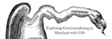
This activity will take students through the steps of visualizing Maryland's Congressional districts …
This activity will take students through the steps of visualizing Maryland's Congressional districts and calucalting the Polsby-Popper Test and interpreting the results using GIS with the ArcMap software application. This documents contains the instructors guide to the "Exploring Gerrymandering in Maryland with GIS" activity. Contents:Information about the scope and content of the activityRecommended readingsActivity Questions
This activity will take students through the steps of visualizing population and …
This activity will take students through the steps of visualizing population and cacluating population density using GIS with the ArcMap software application.
This activity will take students through the steps of calculating and intepreting …
This activity will take students through the steps of calculating and intepreting the Digital Divide Index using GIS with the ArcMap software application.
This activity will take students through the steps of calculating and intepreting …
This activity will take students through the steps of calculating and intepreting the Dissimilarity Index using GIS with the ArcMap software application.
This is not a typical e-book; it is a free, web-based, open-source …
This is not a typical e-book; it is a free, web-based, open-source “textbook” available to anyone interested in using mapping tools to create maps. This e-text focuses primarily on Geographic Information Systems (GIS)—a geospatial technology that enables you to create spatial databases, analyze spatial patterns, and produce maps that communicate more effectively. While this GIS textbook is principally an introduction to GIS, most of the chapter’s concepts are applicable to other geotechnologies including remote sensing, global positioning systems (GPS), Internet mapping, and virtual globes.
Creating good maps and analyzing spatial data is a time consuming and challenging practice, but recently, a new set of powerful mapping tools has enabled almost anyone with a computer to make maps easily and to perform at least some low-level analyses. The results, however, are not encouraging. Most of the new mapmakers do not have adequate training in mapping concepts and spatial analysis principles, and their maps are often improperly designed and do not communicate easily nor effectively. This e-text—GIS Commons—seeks to help you analyze spatial data and communicate more effectively. In short, GIS education is our goal.
Essentials of Geographic Information Systems integrates key concepts behind the technology with …
Essentials of Geographic Information Systems integrates key concepts behind the technology with practical concerns and real-world applications. Recognizing that many potential GIS users are nonspecialists or may only need a few maps, this book is designed to be accessible, pragmatic, and concise. Essentials of Geographic Information Systems also illustrates how GIS is used to ask questions, inform choices, and guide policy. From the melting of the polar ice caps to privacy issues associated with mapping, this book provides a gentle, yet substantive, introduction to the use and application of digital maps, mapping, and GIS.
This practicum subject integrates theory and practice through the design, implementation, and …
This practicum subject integrates theory and practice through the design, implementation, and evaluation of a comprehensive community information infrastructure that promotes democratic involvement and informs community development projects. Students work with Lawrence Community Works, Inc. to involve constituents and generate solutions to an important planning problem in the City of Lawrence, Massachusetts. Final project presentations take place in a public forum, and serve to inform future development of the information infrastructure. Subject begins with an overview of the digital divide, e-government, public participation GIS, and neighborhood information systems. Subject includes a reflection component and a deliberate investigation of race, class, and gender dynamics.
This book is designed to be used as a class text but …
This book is designed to be used as a class text but should be easily accessible to programmers interested in Web Programming. It should even be accessible to an advanced hobbyist.
The original goal behind this text was to help students doing research with me in Web based mapping applications, generally using Open Layers. The idea was to provide persistent storage using REST and simple http request from JavaScript to store the data on a server.
Global Satellite Navigation Systems (GNSS), such as GPS, have revolutionized positioning and …
Global Satellite Navigation Systems (GNSS), such as GPS, have revolutionized positioning and navigation. Currently, four such systems are operational or under development. They are the American GPS, the Russian Glonass, the European Galileo, and the Chinese Beidou-Compass. This course will address: (1) the technical principles of Global Navigation Satellite Systems (GNSS), (2) the methods to improve the accuracy of standard positioning services down to the millimeter accuracy level and the integrity of the systems, and (3) the various applications for positioning, navigation, geomatics, earth sciences, atmospheric research and space missions. The course will first address the space segment, user and control segment, signal structure, satellite and receiver clocks, timing, computation of satellite positions, broadcast and precise ephemeris. It will also cover propagation error sources such as atmospheric effects and multipath. The second part of the course covers autonomous positioning for car navigation, aviation, and location based services (LBS). This part includes the integrity of GNSS systems provided for instance by Space Based Augmentation Systems (e.g. WAAS, EGNOS) and Receiver Autonomous Integrity Monitoring (RAIM). It will also cover parameter estimation in dynamic systems: recursive least-squares estimation, Kalman filter (time update, measurement update), innovation, linearization and Extended Kalman filter. The third part of the course covers precise relative GPS positioning with two or more receivers, static and kinematic, for high-precision applications. Permanent GPS networks and the International GNSS Service (IGS) will be discussed as well. In the last part of the course there will be two tracks (students only need to do one): (1) geomatics track: RTK services, LBS, surveying and mapping, civil engineering applications (2) space track: space based GNSS for navigation, control and guidance of space missions, formation flying, attitude determination The final lecture will be on (scientific) applications of GNSS.
Extends the computing and geographic information systems (GIS) skills developed in 11.520 …
Extends the computing and geographic information systems (GIS) skills developed in 11.520 to include spatial data management in client/server environments and advanced GIS techniques. First half covers the content of 11.523, introducing database management concepts, SQL (Structured Query Language), and enterprise-class database management software. Second half explores advanced features and the customization features of GIS software that perform analyses for decision support that go beyond basic thematic mapping. Includes the half-semester GIS project of 11.524 that studies a real-world planning issue.
The goals of this textbook are to help students acquire the technical …
The goals of this textbook are to help students acquire the technical skills of using software and managing a database, and develop research skills of collecting data, analyzing information and presenting results. We emphasize that the need to investigate the potential and practicality of GIS technologies in a typical planning setting and evaluate its possible applications. GIS may not be necessary (or useful) for every planning application, and we anticipate these readings to provide the necessary foundation for discerning its appropriate use. Therefore, this textbook attempts to facilitate spatial thinking focusing more on open-ended planning questions, which require judgment and exploration, while developing the analytical capacity for understanding a variety of local and regional planning challenges. While this textbook provides the background for understanding the concepts in GIS as applicable to urban and regional planning, it is best when accompanied by a hands-on tutorial, which will enable readers to develop an in-depth understanding of the specific planning applications of GIS. Chapters in this text book are either composed by the editors using Creative Common materials, or linked to a book chapter scanned copy in the library reserve. In the end of each chapter, we also provided several discussion questions, together with contextual applications through some web links.
The course discusses several Geopgraphical Information System (GIS) and Remote Sensing (RS) …
The course discusses several Geopgraphical Information System (GIS) and Remote Sensing (RS) tools relevant for analysis of (problems in and aspects of) water systems. Within the course, several applications are introduced. These applications include GIS tools to determine mapping of surface water systems (catchment delineation, reservoirs and canal systems). The RS tools include determination of evaporation and soil moisture patterns, and measurement of water levels in surface water systems. In exercises and lectures, different tools and applications are offered. For each application, assignments are given to allow students to acquire relevant skills. The course structure combines assignments and introductory lectures. Each week participants work on one assignment. These assignments are discussed in the next lecture and graded. Each week a new assignment is introduced, together with supporting materials (an article discussing the relevant application) and lectures (introducing theoretical issues). The study material of the course consists of a study guide, assignments, lecture material and articles. The final mark is the average of the grades of the individual assignments.
This activity will take students through the steps of visualizing and intepreting the …
This activity will take students through the steps of visualizing and intepreting the distribution and spread of hte Sika Deer in Maryland using GIS with the ArcMap software application.
This course provides an introduction to the transportation industry's major technical challenges …
This course provides an introduction to the transportation industry's major technical challenges and considerations. For upper level undergraduates interested in learning about the transportation field in a broad but quantitative manner. Topics include road vehicle engineering, internal combustion engines, batteries and motors, electric and hybrid powertrains, urban and high speed rail transportation, water vessels, aircraft types and aerodynamics, radar, navigation, GPS, GIS. Students will complete a project on a subject of their choosing.
No restrictions on your remixing, redistributing, or making derivative works. Give credit to the author, as required.
Your remixing, redistributing, or making derivatives works comes with some restrictions, including how it is shared.
Your redistributing comes with some restrictions. Do not remix or make derivative works.
Most restrictive license type. Prohibits most uses, sharing, and any changes.
Copyrighted materials, available under Fair Use and the TEACH Act for US-based educators, or other custom arrangements. Go to the resource provider to see their individual restrictions.